
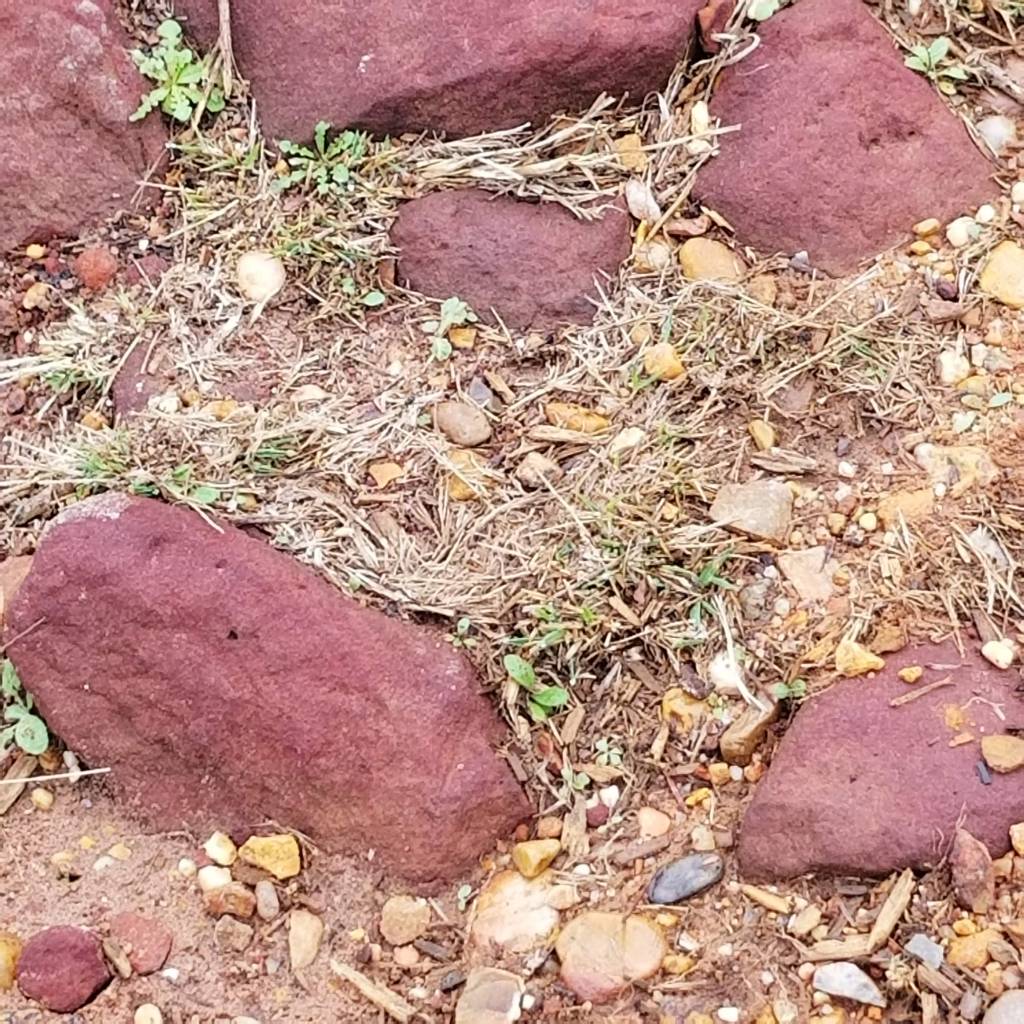
Rocks! what a way to start a post. Rocks! There is a method to this madness though. Bastrop State park in Bastrop Texas is a park totally built by Company 1805 and Company 1811 of the Civilian Conservation Corps from 1933 to 1939 and everything is built from this, red sandstone.
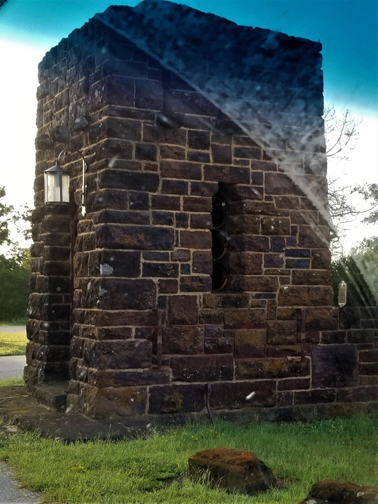
I love visiting anything built by the CCC to admire the unique architecture used. We just don’t see it today. And Bastrop is full of beautiful examples.
Texas has no income tax, and the parks department was formed in 1921 so at the time the CCC operated there was a lot of work in Texas and Texas has a lot of CCC built parks.
The CCC work in this park gives it the feel of a national park and the structures became models for other parks around Texas and the nation.
Bastrop is not a common name, but it is the name of a city, a county and a State Park in Texas. And it’s an interesting story as to who it’s named after.
Originally known as Mina, ( is it Mine-a or Mean-a I dunno); the area was first settled as a Spanish fort where the San Antonio Road crossed the Colorado River.
It is Named for Phillip Hendrik Nering Bogel, a Dutchman. Bogel was a tax collector in the Netherlands. In 1793 Bogel was accused of using tax money for personal uses and a 1000 ducat reward was placed on his person. Bogel fled The Netherlands using the surname Bastrop and arrived in Phildelphia.
He presented himself in Texas to Moses and Stephen Austin as Felipe Enrique Neri, Baron de Bastrop. He claimed to be a Dutch nobleman who fled in advance of Napoleon’s invasion. He helped Austin secure his land grants in Mexico and became the commissioner of colonization for Austin’s colony. He died in 1827 and it was many years after the town was named for him that his true identity was revealed.
The first 2000 acres were donated to the State by the City of Bastrop and today the park encompasses around 6000 acres. The CCC began construction in 1933.
Everything in this park is CCC built from picnic tables to the drinking fountains.
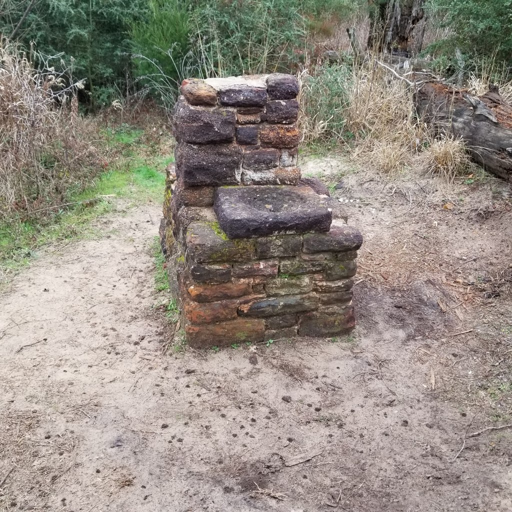
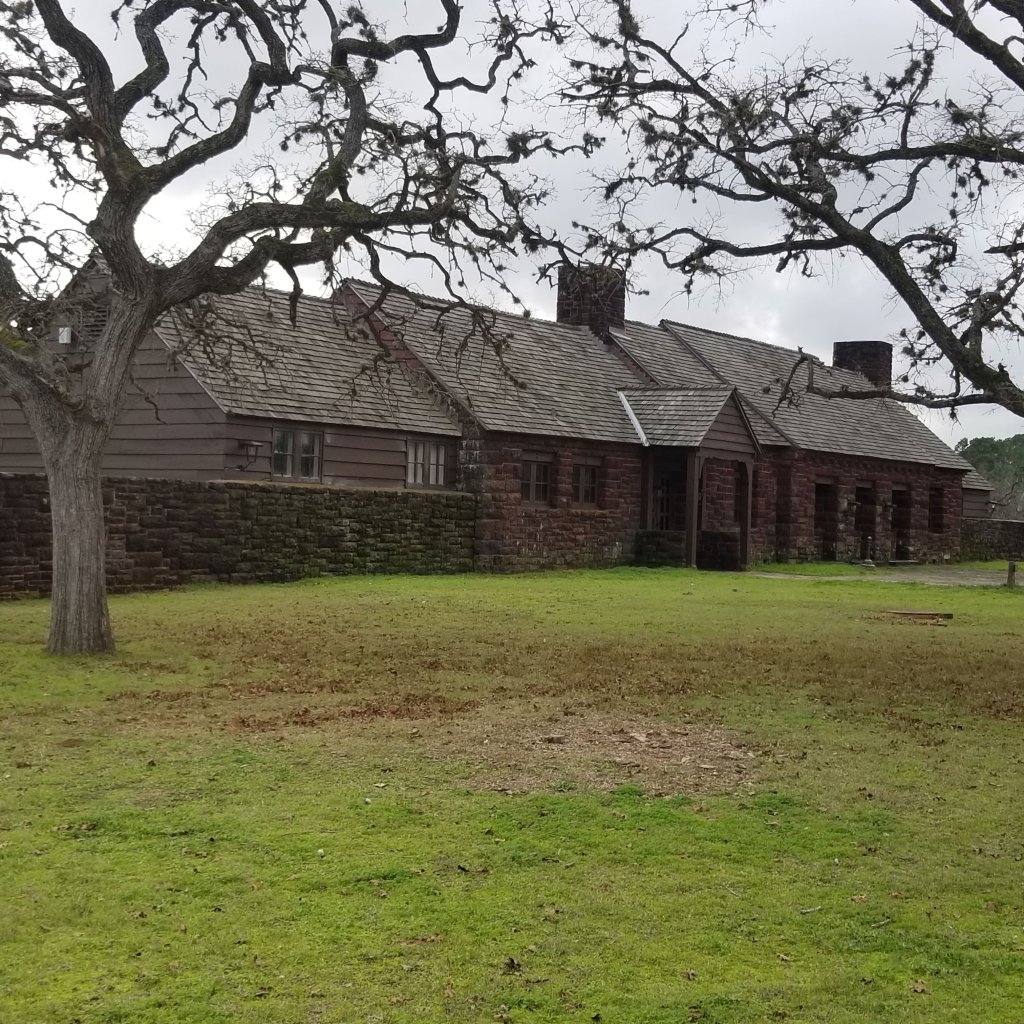
This hike started at the refectory. The Refectory, a fancy name for the dining hall used by the CCC workers.
The trails here were fairly easy although there was more elevation gain then I expected. What was surprising, after endless miles walking over Limestone and rocky ground, and being only 30 miles outside of Austin: the trails were sand.

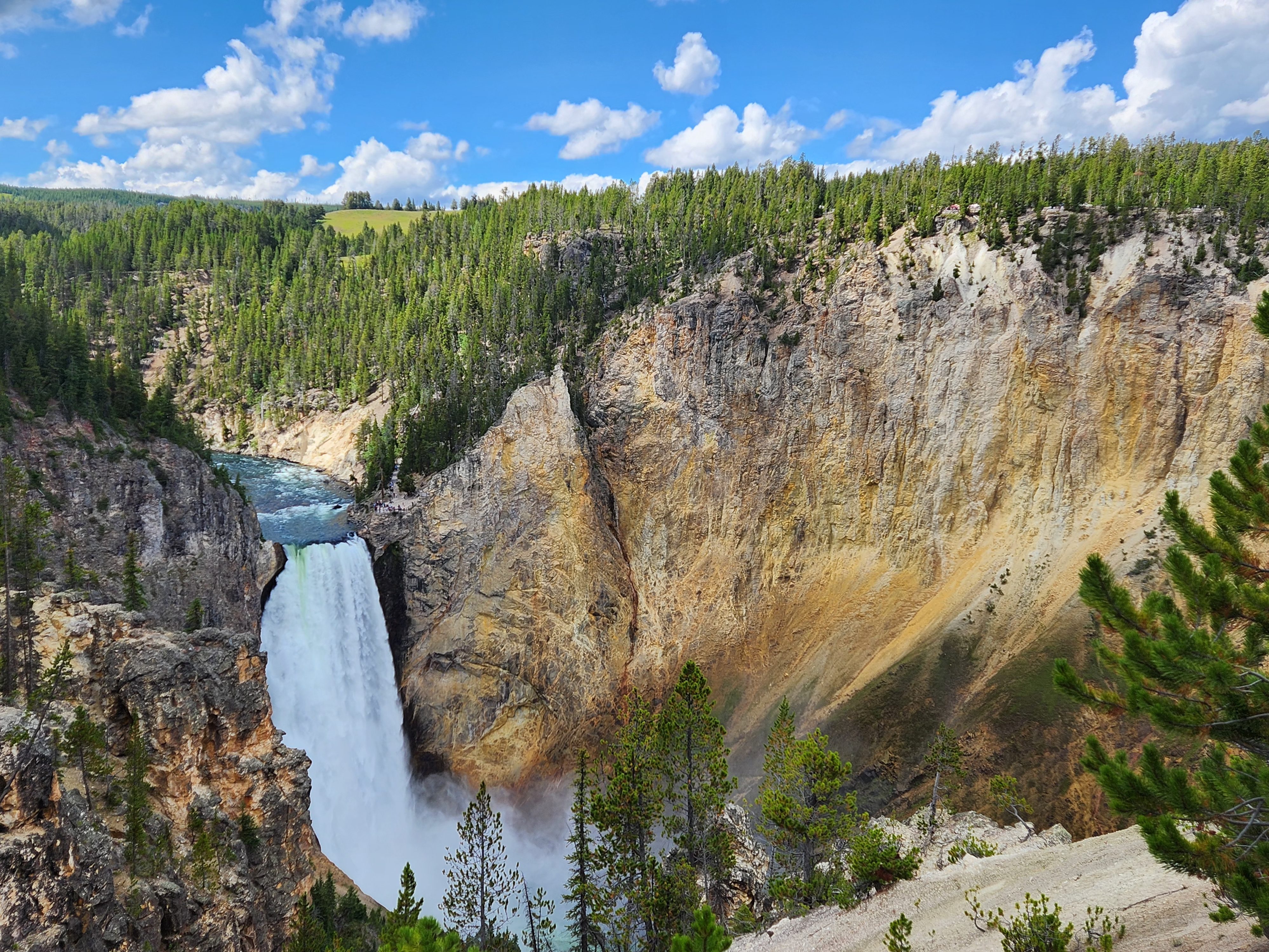
Bastrop lies in an area of Loblolly Pines known as the Lost Pines, so it was much like hiking back in the coastal plain of North Carolina.
The Lost Pines is a belt about 13 miles long, of Loblolly Pines that are separated by over 100 miles from the Piney Woods of Eastern Texas. Within the belt are two state parks, Bastrop and Buescher (another pronunciation lesson, it’s Bisher not busher). This stand of Loblolly Pines is the westernmost group in America. It is believed that the Piney Woods extended here at one time but as the weather in Texas got drier, the pines died in between. These Loblolly Pines have actually evolved to need 30% less water then those in the East Texas Piney Woods.
I started this hike on the Farkleberry Trail… hey I don’t name ’em I just hike ’em. But this begs one to find out what is a Farkleberry. Well it is a small black berry that grows on a evergreen bush about 5 to 12 feet tall. They are edible but are tough and bitter. Related to the Huckleberry.

I headed for the scenic overlook and gazebo that I could see off in the distance.
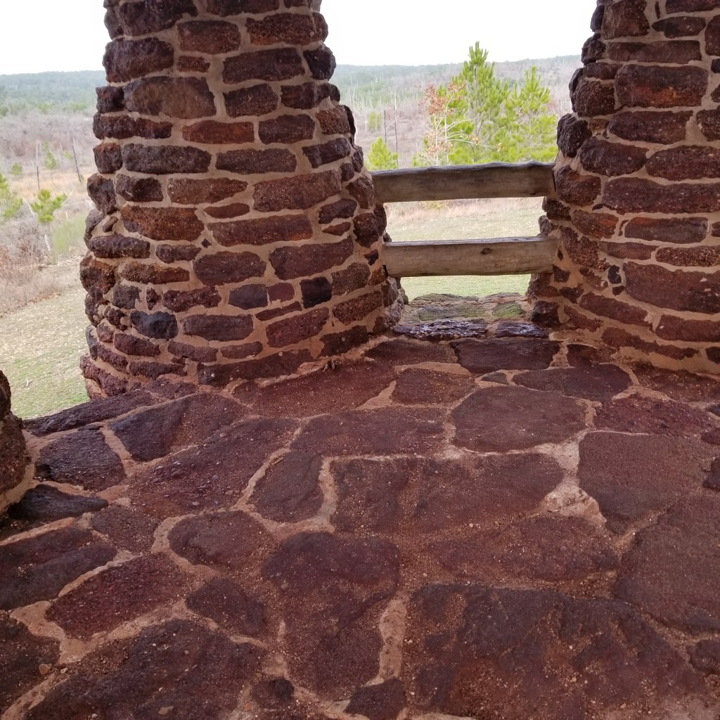
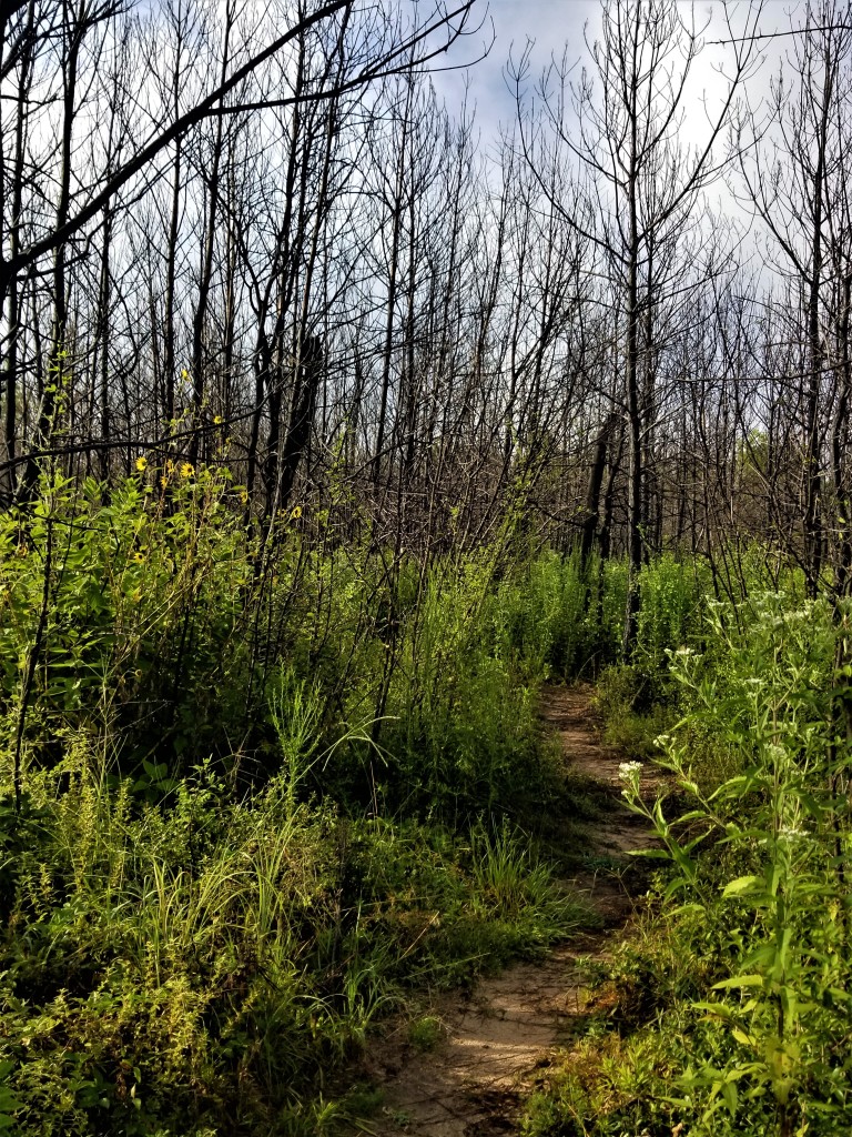
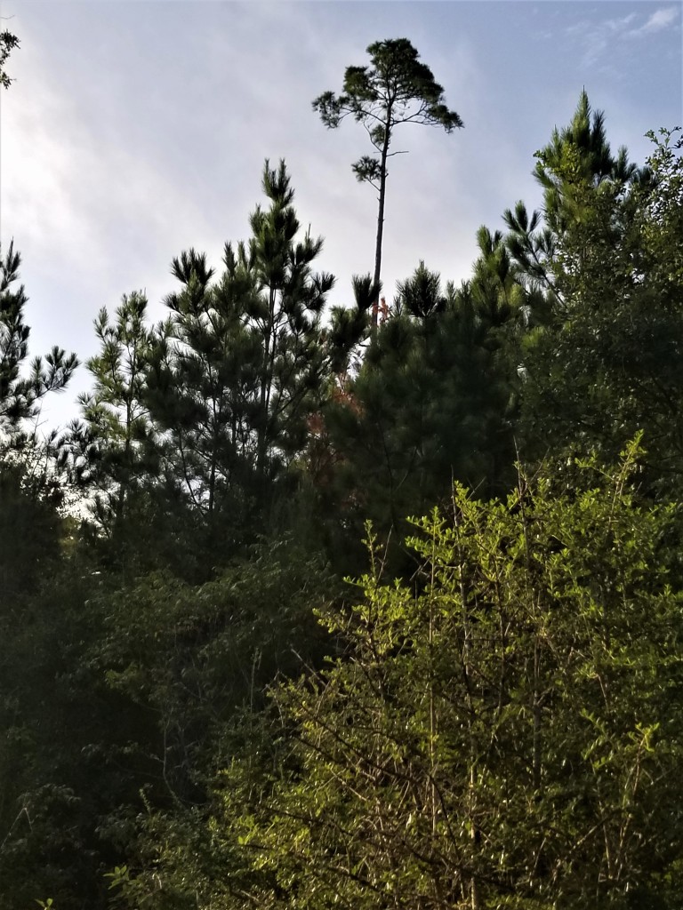
One thing you probably notice in the above picture is that the loblolly pines are not very tall. You may also notice some fire scarred tree trunks. In 2011 Bastrop State Park was swept by a catastrophic forest fire and the grand stand of Loblolly Pines was 90% destroyed. Thankfully the unique CCC work was saved except for a couple of roofs on the overlooks.
In 2011 Texas had one of it’s driest years on record. It hadn’t been this dry since the mid fifties. The drought and heat wave even superseded the conditions during the dust bowl. 73 days of temperatures exceeding 100 degrees. Labor Day weekend the area was receiving heavy winds from Tropical Storm Lee which toppled trees into power lines causing sparks and two fires erupted in the area. These fires both blew into the tall pines and merged near the park. A third fire then began. Although half of the park had already burned the third fire swept through the trees of the park. of the 6000 acres in Bastrop State Park only 50 to 100 acres remained untouched. Thankfully this saved most of the CCC projects except two overlooks and a vintage rain shelter building, (Gazebo?”)
This is known as the Bastrop County Complex Fire, the largest and most destructive in Texas history. It eventually burned over 36000 acres, destroyed 1700 homes and businesses and took two lives over its 55-day life.
Restoration is taking place, but it is a slow process that employs planting seedlings and doing controlled burns. I learned in North Carolina that a controlled fire is a friend to the Loblolly Pines. It promotes their growth.
In 2021 a controlled burn got away from the forest rangers and there was a fear of a repeat although the fire was 90% contained after a couple of days.

Anyone can see a forest fire. Skill lies in sniffing the first smoke.
Robert A. Heinlein
I reached the gazebo.
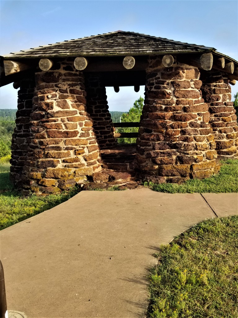

How can you not take a few minutes to admire the amazing handiwork done so many years ago. In this park to such an extent that it was a model for future works of the CCC. And because of it’s uniqueness Bastrop State Park is on the National Register of Historic Places.
I left this overlook to cross the road and head out into the backcountry of the park. The trails were barely visible in many places and judging by the spider webs I encountered not many people come out past the road.

I entered an area where the fire has completely destroyed the pines and I don’t think these are coming back. They were a younger stand of pines .
I continued out to the second road. Here the trail now follows the road for a half mile to the other leg of the loop. It used to cross the road and the loop continued on the other side, but the park has closed that area indefinitely due to fire damage. I headed back in fighting swarms of grasshoppers and eating spider webs towards Fehr’s Overlook.

Fehr’s Overlook is the other high point in the park. Here the CCC crafted yet another work, a shelter to sit and admire the area. It is sporting a new roof.


I hung out here for quite a while, ate my lunch and admired the building. I think these were all originally built with the dry stack method. This is where the rocks are carefully stacked, and no mortar is used. The mortar here and in the above picture of the gazebo was added as repairs from the fire were performed. That’s an opinion of mine after looking at this structure. I then headed out to the original day use area and the water fountains. As I hiked back towards the refectory, I came across two excellent bridges built by the CCC.


This side of the park is much more rugged as the trails cross the canyons of Copperas Creek and it’s tributaries.


Bastrop, who knew! I started the day going to this park because I had never been there. I left wanting to see more.

My favorite park! What a gem.
Tom
LikeLike
Yes sir it is. Too bad about the fire though. Coming here from NC I love to go to the Lost Pines area. Reminds me of home.
LikeLike